To narrow your search results, enter the model number in the Search box above.
You can change the order of the results by clicking on a column header ("Model", "Year", etc.)

|
GPS-95CP |
Si-Tex Marine |
Marine GPS |
2009 |
|
Description: Internal Antenna Model. Marine GPS Type: Chartplotter - Screen Size: 4.3" - Screen Type: TFT LCD - GPS Navigation Features: Built-In Antenna, Track Log - Preloaded Map Coverage: Worldwide - # of Waypoints: 2000 - I/O Interfaces: NMEA - Battery Type: Li-Ion |

|
967c 3D Combo |
Humminbird |
Marine GPS |
2007 |
|
Description: Marine GPS Type: Chartplotter, Fishfinder, Sonor - Screen Size: 8" - Resolution: 480x800 - GPS Navigation Features: Fish Identifier, Split Screen, 2D/3D Mapping, Track Log - Depth Range (Feet): 1000 - # of Waypoints: 3000 - Transducer Type: Dual Beam, Dual Frequency - Transducer Frequency: 83/455 kHz - Transducer Wattage: 8000 |

|
GO5 XSE |
Simrad |
Marine GPS |
2016 |
|
Description: Marine GPS Type: Chartplotter - Screen Size: 5" - Screen Type: LCD |
|
|
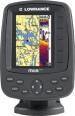
Elite-9x CHIRP |
Lowrance |
Marine GPS |
2015 |
|
Description: Marine GPS Type: Fishfinder - Screen Size: 9" - Screen Type: TFT LCD - Resolution: 800x480 - GPS Navigation Features: Built-In Antenna |

|
EC-7 IF |
Si-Tex Marine |
Marine GPS |
2010 |
|
Description: Internal Antenna Model. Marine GPS Type: Chartplotter, Fishfinder - Screen Size: 7" - Resolution: 320x240, 800x480 - Memory Format (MSD): SD - GPS Navigation Features: Built-In Antenna, Automatic Rerouting, WAAS Receiver, Split Screen - Preloaded Map Coverage: Worldwide - Transducer Type: Dual Frequency - Transducer Wattage: 600 - I/O Interfaces: NMEA |

|
941XD |
Northstar |
Marine GPS |
1999 |
|
Description: Marine GPS Type: Chartplotter - Screen Size: 5.7" - Screen Type: LCD - Resolution: 320x240 - GPS Navigation Features: NOAA Natucal Charts, Anti-Glare, WAAS Receiver - Preloaded Map Coverage: Worldwide - # of Waypoints: 1000 - I/O Interfaces: RS-232, NMEA |

|
FR7061 |
Furuno USA |
Marine GPS |
1998 |
|
Description: Marine GPS Type: Radar - Screen Size: 12" - Screen Type: CRT - GPS Navigation Features: Built-In Antenna - I/O Interfaces: NMEA |

|
GPSMAP 198C Sounder |
Garmin |
Marine GPS |
2005 |
|
Description: Marine GPS Type: Chartplotter, Sonor - Screen Size: 5" - Screen Type: TFT LCD - Resolution: 234x320 - Transducer Type: Dual Frequency |
|
|
858c HD DI Combo |
Humminbird |
Marine GPS |
2012 |
|
Description: Marine GPS Type: Chartplotter, Fishfinder, Sonor - Screen Size: 7" - Screen Type: TFT LCD - Resolution: 480x800 - GPS Navigation Features: Widescreen - Depth Range (Feet): 1500 - # of Waypoints: 3000 - Transducer Type: Dual Beam - Transducer Frequency: 83/200 kHz - Transducer Wattage: 4000 |
|
|
FRS1000C |
Furuno USA |
Marine GPS |
2000 |
|
Description: With 4" Open Array Antenna. Marine GPS Type: Chartplotter, Sonor, Radar - Screen Size: 10.4" - Screen Type: TFT LCD - GPS Navigation Features: Remote, Compass - Transducer Type: Dual Frequency - Transducer Frequency: 50/200 kHz - Transducer Wattage: 600 |

|
GPSMAP 6008 |
Garmin |
Marine GPS |
2010 |
|
Description: Marine GPS Type: Chartplotter - Screen Size: 8.4" - Resolution: 640x480 - Memory Format (MSD): SD - GPS Navigation Features: External Antenna, Tide Table - I/O Interfaces: NMEA |

|
535 Portable |
Humminbird |
Marine GPS |
2006 |
|
Description: Marine GPS Type: Sonor - Screen Size: 5" - Screen Type: FSTN - Resolution: 320x320 - Depth Range (Feet): 800 - Transducer Type: Single Frequency - Transducer Frequency: 200 kHz - Transducer Wattage: 2000 |
|
|
Elite-4 HDI Gold |
Lowrance |
Marine GPS |
2013 - 2015 |
|
Description: Marine GPS Type: Chartplotter, Fishfinder - Screen Size: 4.3" - Screen Type: TFT LCD - Resolution: 320x240 - Memory Format (MSD): Micro SD - GPS Navigation Features: Built-In Antenna - Transducer Frequency: 83/200 kHz |

|
Globalmap 5200C |
Lowrance |
Marine GPS |
2006 |
|
Description: Marine GPS Type: Chartplotter - Screen Size: 10.4" - Screen Type: LCD - Resolution: 480x480 - GPS Navigation Features: WAAS Receiver - Battery Type: DC Adaptor |

|
GPSMAP 620 |
Garmin |
Marine GPS |
2009 |
|
Description: Marine GPS Type: Chartplotter - Screen Size: 5.2" - Resolution: 800x480 - Memory Format (MSD): Internal - GPS Navigation Features: 2D/3D Mapping, Built-In Antenna, Automatic Rerouting, Track Log, Tide Table, Touchscreen, Sunset/Sunrise Calculator, Voice Guidance - Preloaded Map Coverage: Canada, Puerto Rico, United States - # of Waypoints: 1500 - Battery Type: Li-Ion |

|
GPSMAP 178C Sounder (Internal Antenna/Single Frequency Transducer Version) |
Garmin |
Marine GPS |
2004 |
|
Description: Marine GPS Type: Chartplotter, Sonor - Screen Size: 4.5" - Screen Type: LCD - GPS Navigation Features: Built-In Antenna, Tide Table - Preloaded Map Coverage: Australia, Europe, South America, United States - Transducer Type: Single Frequency - Transducer Frequency: 200 MHz - Transducer Wattage: 400 |

|
X86 DS |
Lowrance |
Marine GPS |
2006 |
|
Description: Marine GPS Type: Fishfinder, Sonor - Screen Size: 4.5" - Screen Type: LCD - Resolution: 240x240 - GPS Navigation Features: Thermometer, Language, Photo Viewer - Depth Range (Feet): 1000 - Transducer Type: Dual Frequency, Skimmer - Transducer Frequency: 83/200 kHz - Transducer Wattage: 1500 |

|
LMS-330C |
Lowrance |
Marine GPS |
2004 |
|
Description: Marine GPS Type: Chartplotter, Fishfinder, Sonor - Screen Type: TFT LCD - Resolution: 320x240, 640x480 - Memory: 256 MB - Memory Format (MSD): SD - GPS Navigation Features: Auto Zoom, Automatic Rerouting, Speed/Temp Sensor, Track Log, Language, Split Screen, Manual Zoom - Preloaded Map Coverage: Hawaii, United States, United States (Coastal), United States (Lakes/Rivers) - Depth Range (Feet): 900 - Transducer Type: Single Frequency, Skimmer - Transducer Frequency: 200 kHz - Transducer Wattage: 2400 - I/O Interfaces: NMEA - Battery Type: DC Adaptor |

|
FR7252/4 |
Furuno USA |
Marine GPS |
2000 |
|
Description: With 4" Open Array Antenna. Marine GPS Type: Radar - Screen Size: 12" - Screen Type: CRT - Resolution: 480x640 - GPS Navigation Features: Track Log, Built-In Antenna |
|
|
Echo 501 |
Garmin |
Marine GPS |
2014 |
|
Description: Non Transducer Model. Marine GPS Type: Fishfinder - Screen Size: 5" - Screen Type: LCD - Resolution: 234x320 - GPS Navigation Features: Track Log, Fish Identifier, Thermometer, Split Screen - Depth Range (Feet): 2300 |
|
|
EchoMAP CHIRP 93sv |
Garmin |
Marine GPS |
2015 |
|
Description: Marine GPS Type: Chartplotter, Fishfinder - Screen Size: 9" - Screen Type: LCD - Resolution: 800x480 - Memory Format (MSD): Micro SD - GPS Navigation Features: Tide Table - Preloaded Map Coverage: United States - Depth Range (Feet): 2300 - Transducer Type: Dual Beam, Dual Frequency - Transducer Frequency: 260/455/800 kHz - I/O Interfaces: NMEA |

|
X105C DF |
Lowrance |
Marine GPS |
2004 |
|
Description: Marine GPS Type: Fishfinder, Sonor - Screen Size: 5" - Screen Type: LCD - Resolution: 320x240 - Depth Range (Feet): 2500 - Transducer Type: Dual Frequency, Skimmer - Transducer Frequency: 50/200 kHz - Transducer Wattage: 4000 |

|
TriFinder 2 |
Eagle Electronics |
Marine GPS |
2002 |
|
Description: Marine GPS Type: Fishfinder, Sonor - Screen Type: LCD - Resolution: 240x160 - GPS Navigation Features: Thermometer, Track Log, Fish Identifier, Automatic Rerouting - Depth Range (Feet): 800 - Transducer Wattage: 1500 |

|
Fishfinder 100 |
Garmin |
Marine GPS |
1999 |
|
Description: Non Transducer Model. Marine GPS Type: Sonor - Screen Size: 2.5" - Screen Type: LCD - Resolution: 160x100 - Memory Format (MSD): Internal - GPS Navigation Features: Language |

|
DFF3 |
Furuno USA |
Marine GPS |
2009 |
|
Description: Marine GPS Type: Black Box Sonor - Depth Range (Feet): 9000 - Transducer Type: Dual Frequency - Transducer Frequency: 50/200 kHz - Transducer Wattage: 600 - I/O Interfaces: RJ-45 |

|
LCX-18C |
Lowrance |
Marine GPS |
2002 |
|
Description: Marine GPS Type: Chartplotter, Sonor - Resolution: 320x240, 640x480 - GPS Navigation Features: Track Log, Language - Preloaded Map Coverage: United States, United States (Lakes/Rivers) - Depth Range (Feet): 9800 - Transducer Type: Dual Frequency, Skimmer - Transducer Frequency: 50/200 kHz - Transducer Wattage: 8000 - Battery Type: DC Adaptor |

|
EC-7 |
Si-Tex Marine |
Marine GPS |
2010 |
|
Description: External Antenna Model. Marine GPS Type: Chartplotter - Screen Size: 7" - Resolution: 320x240, 800x480 - Memory Format (MSD): SD - GPS Navigation Features: External Antenna, Automatic Rerouting, Split Screen, WAAS Receiver - Preloaded Map Coverage: Worldwide - Transducer Type: Dual Frequency - Transducer Wattage: 600 - I/O Interfaces: NMEA |

|
778c |
Humminbird |
Marine GPS |
2008 |
|
Description: Marine GPS Type: Sonor - Screen Size: 5" - Screen Type: TFT LCD - Resolution: 640x640 - Depth Range (Feet): 1500 - # of Waypoints: 750 - Transducer Type: Dual Beam - Transducer Frequency: 83/200 kHz - Transducer Wattage: 4000 |

|
CP590 |
Standard Horizon |
Marine GPS |
2011 |
|
Description: Marine GPS Type: Chartplotter - Screen Size: 12" - Screen Type: TFT LCD - Resolution: 640x480, 800x600 - GPS Navigation Features: External Antenna, Track Log, WAAS Receiver, Split Screen - Preloaded Map Coverage: Bahamas, United States (Coastal) - # of Waypoints: 3000 - I/O Interfaces: NMEA |

|
Chart Master V6i |
Interphase Tech |
Marine GPS |
2004 |
|
Description: Marine GPS Type: Chartplotter, Sonor - Screen Size: 5.7" - Screen Type: LCD - Resolution: 234x320, 640x480 - GPS Navigation Features: Automatic Rerouting, WAAS Receiver, Compass, Built-In Antenna, Track Log, Tide Table, Split Screen, 2D/3D Mapping, Depth Alarm - Preloaded Map Coverage: Worldwide - # of Waypoints: 500 - Transducer Type: Single Frequency - I/O Interfaces: NMEA, USB |

|
Magna II Portable |
Eagle Electronics |
Marine GPS |
1990 |
|
Description: Marine GPS Type: Fishfinder, Sonor - GPS Navigation Features: Fish Identifier, Thermometer, Depth Alarm |
|
|
GPSMAP 220 |
Garmin |
Marine GPS |
1994 |
|
Description: Marine GPS Type: Chartplotter - Screen Type: TFT LCD - # of Waypoints: 500 |

|
Explorer 557 |
Northstar |
Marine GPS |
2009 |
|
Description: Marine GPS Type: Chartplotter - Screen Size: 5" - Screen Type: TFT LCD - Resolution: 640x480 - Memory: 32 MB - GPS Navigation Features: Language, WAAS Receiver, Split Screen, Track Log, Speed/Temp Sensor - Transducer Type: Dual Frequency - I/O Interfaces: NMEA |

|
958c Combo |
Humminbird |
Marine GPS |
2009 |
|
Description: Marine GPS Type: Chartplotter - Screen Type: TFT LCD - Resolution: 480x800 - GPS Navigation Features: WAAS Receiver - Depth Range (Feet): 1500 - # of Waypoints: 3000 - Transducer Type: Dual Beam - Transducer Frequency: 83/200 kHz - Transducer Wattage: 8000 |

|
Globalmap 8200C |
Lowrance |
Marine GPS |
2010 |
|
Description: Marine GPS Type: Chartplotter - Screen Size: 8.4" - Screen Type: TFT LCD - Resolution: 240x240 - Memory Format (MSD): SD - GPS Navigation Features: WAAS Receiver - Preloaded Map Coverage: Hawaii, United States, United States (Lakes/Rivers) - Battery Type: DC Adaptor |

|
587ci Combo |
Humminbird |
Marine GPS |
2008 |
|
Description: Marine GPS Type: Sonor - Screen Size: 4.5" - Screen Type: FSTN - Resolution: 320x240 - GPS Navigation Features: Built-In Antenna, WAAS Receiver - Depth Range (Feet): 800 - # of Waypoints: 3000 - Transducer Type: Dual Beam - Transducer Frequency: 83/200 kHz - Transducer Wattage: 2400 |
|
M68i S/Map |
Lowrance |
Marine GPS |
2003 |
|
Description: Marine GPS Type: Fishfinder, Sonor |

|
6100i |
Northstar |
Marine GPS |
2007 |
|
Description: With 12" Screen. Marine GPS Type: Chartplotter - Screen Size: 12" - Resolution: 480x640 - GPS Navigation Features: Track Log, Sonor Alarm, Depth Alarm, WAAS Receiver, Language - Transducer Type: Dual Frequency - Transducer Frequency: 50/200 kHz - Transducer Wattage: 600 - Battery Type: DC Adaptor |

|
E120W |
Raymarine |
Marine GPS |
2009 |
|
Description: Marine GPS Type: Chartplotter, Fishfinder, Sonor - Screen Size: 12.1" - Resolution: 1280x1024, 1280x800 - GPS Navigation Features: Radar, 2D/3D Mapping, Language, Touchscreen, Widescreen, Track Log - Preloaded Map Coverage: Europe |

|
Globalmap 4900M |
Lowrance |
Marine GPS |
2005 |
|
Description: Marine GPS Type: Chartplotter - Screen Size: 8.4" - Screen Type: LCD - Resolution: 480x640 - Memory: 30 GB - Memory Format (MSD): Internal - GPS Navigation Features: WAAS Receiver, Split Screen, Language, Automatic Rerouting - # of Waypoints: 1000 - I/O Interfaces: RS-232 - Battery Type: DC Adaptor |

|
Echo 300c |
Garmin |
Marine GPS |
2011 |
|
Description: Marine GPS Type: Fishfinder - Screen Size: 3.5" - Screen Type: FSTN - Resolution: 240x320, 320x240 - GPS Navigation Features: Sonor Alarm, Track Log, Depth Alarm, Whiteline, Fish Identifier, Speed/Temp Sensor, Auto Zoom, Split Screen - Preloaded Map Coverage: United States (Coastal) - Depth Range (Feet): 1500 - Transducer Type: Dual Beam - Transducer Frequency: 77/200 kHz - Transducer Wattage: 300 |
|
|
Elite-7 Ti |
Lowrance |
Marine GPS |
2016 |
|
Description: Marine GPS Type: Chartplotter, Fishfinder - Screen Size: 7" - Screen Type: TFT LCD - Resolution: 800x480 - Memory Format (MSD): Micro Drive - GPS Navigation Features: Built-In Antenna, Wireless, Touchscreen |

|
NAV 6500 |
Magellan |
Marine GPS |
2000 - 2008 |
|
Description: Marine GPS Type: Chartplotter - Screen Size: 4.7" - GPS Navigation Features: Automatic Rerouting, WAAS Receiver - # of Waypoints: 500 |

|
Ultra Classic |
Eagle Electronics |
Marine GPS |
1999 |
|
Description: Marine GPS Type: Chartplotter, Sonor - Screen Size: 3.3" - Resolution: 160x160 - GPS Navigation Features: Auto Zoom, WAAS Receiver, DSP - Preloaded Map Coverage: Bahamas, Hawaii, Mexico, United States, United States (Coastal), United States (Lakes/Rivers) - Depth Range (Feet): 600 - # of Waypoints: 750 - Transducer Type: Skimmer - Transducer Frequency: 192 kHz - Transducer Wattage: 600 |
|
|
Elite-4x |
Lowrance |
Marine GPS |
2012 - 2014 |
|
Description: Marine GPS Type: Chartplotter, Fishfinder - Screen Size: 3.5" - Screen Type: TFT LCD - Resolution: 320x240 - Memory Format (MSD): Micro SD - GPS Navigation Features: Built-In Antenna - Depth Range (Feet): 1000 - Transducer Frequency: 83/200 kHz |

|
570 DI |
Humminbird |
Marine GPS |
2011 |
|
Description: Marine GPS Type: Sonor - Screen Size: 5" - Screen Type: FSTN - Resolution: 640x320 - GPS Navigation Features: Down Imager, Built-In Antenna, WAAS Receiver - Depth Range (Feet): 500 - # of Waypoints: 3000 - Transducer Type: Quad Beam - Transducer Frequency: 200/455/800 kHz - Transducer Wattage: 2400 |
|
|
Striker 4 |
Garmin |
Marine GPS |
2016 |
|
Description: Marine GPS Type: Fishfinder - Screen Size: 3.5" - Screen Type: LCD - Resolution: 480x320 - GPS Navigation Features: Split Screen, Thermometer, Fish Identifier - Depth Range (Feet): 1600 - Transducer Type: Dual Beam, Dual Frequency - Transducer Frequency: 50/200 kHz - Transducer Wattage: 200 |
|
|
Echo 201 |
Garmin |
Marine GPS |
2014 |
|
Description: Transducer Model. Marine GPS Type: Fishfinder - Screen Size: 5" - Screen Type: LCD - Resolution: 320x480 - GPS Navigation Features: Thermometer, Split Screen, Track Log, Fish Identifier - Depth Range (Feet): 1750 - Transducer Type: Dual Beam, Dual Frequency |
|
|
HDS-8 Gen2 |
Lowrance |
Marine GPS |
2012 |
|
Description: 83/200 kHz Transducer Model. Marine GPS Type: Chartplotter, Sonor - Screen Size: 8.4" - Screen Type: TFT LCD - Resolution: 600x800 - Memory Format (MSD): SD - GPS Navigation Features: Language - Transducer Frequency: 83/200 kHz - I/O Interfaces: NMEA, RJ-45 |

|
1942 |
Furuno USA |
Marine GPS |
1998 |
|
Description: With 4" Open Array Antenna. Marine GPS Type: Radar - Screen Size: 10" - Screen Type: CRT - Resolution: 480x640 - GPS Navigation Features: Built-In Antenna |

 Home
Home


 Car Stereo


